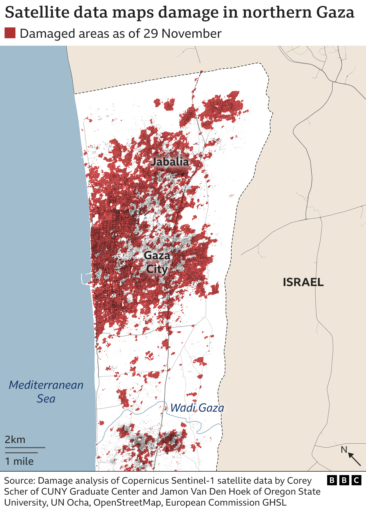
New satellite foto wey BBC commission show di damage across northern Gaza, before dem start di temporary ceasefire between Israel and Hamas.
Dem take di satellite foto last week Thursday, just before di suspension of hostilities come into force, afta weeks of Israeli air strikes and on-di-ground fighting. Separate satellite data analysis also provide snapshot of di destruction across di whole of Gaza.
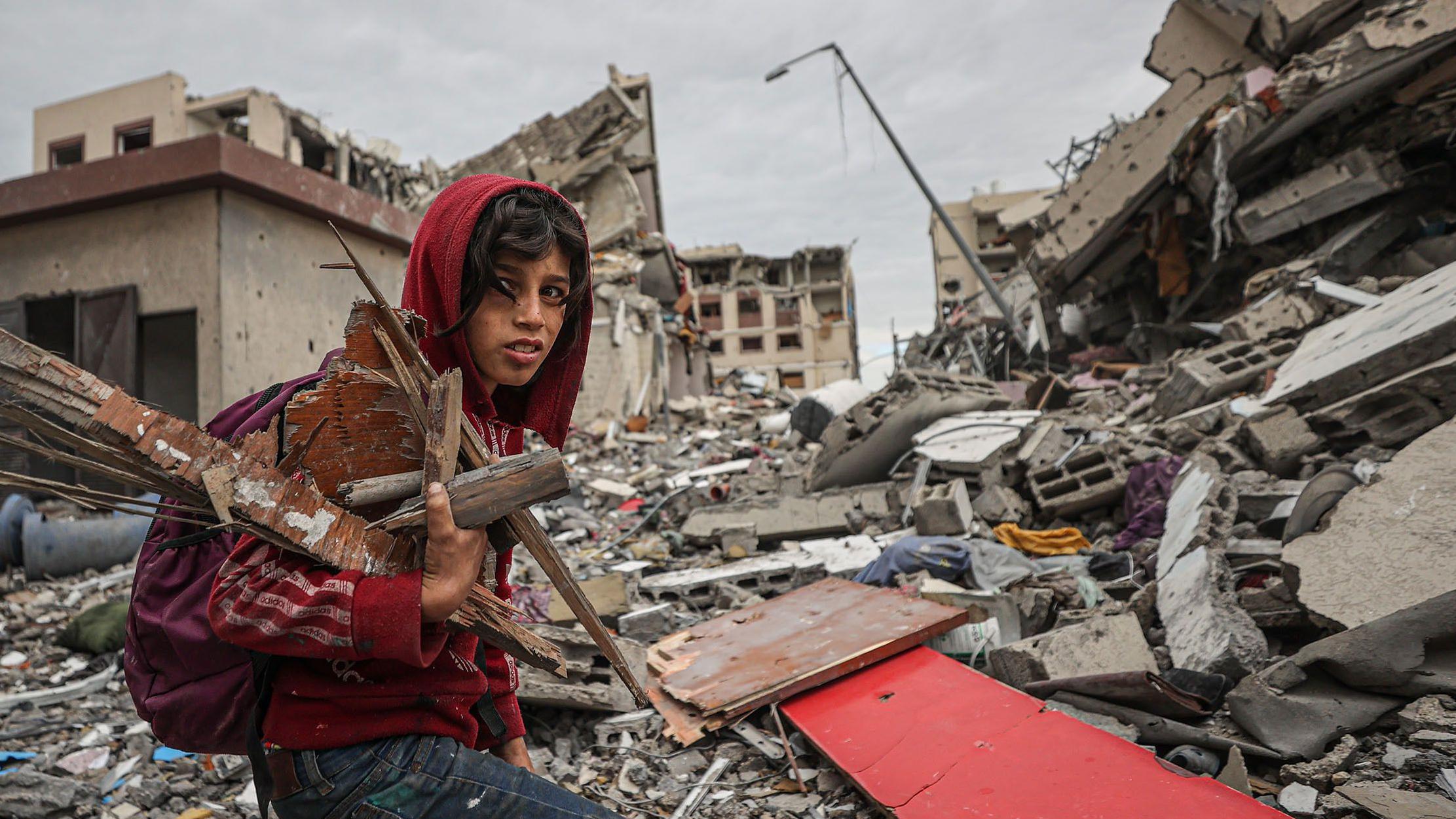
Drone fotos and video wey dem verify also show buildings and entire neighbourhoods wey don reduce to dust. While northern Gaza na di focus of di Israeli ground offensive and na dem experience destruction pass, widespread damage don extend to di entire strip.
Israel say northern Gaza, wey include di major urban centre of Gaza City, na “centre of gravity of Hamas”, di group behind di deadly 7 October attacks on Israel. Israel tok say im bombing campaign don successfully target Hamas commanders and fighters as dem accuse di group say dem dey go civilian areas.
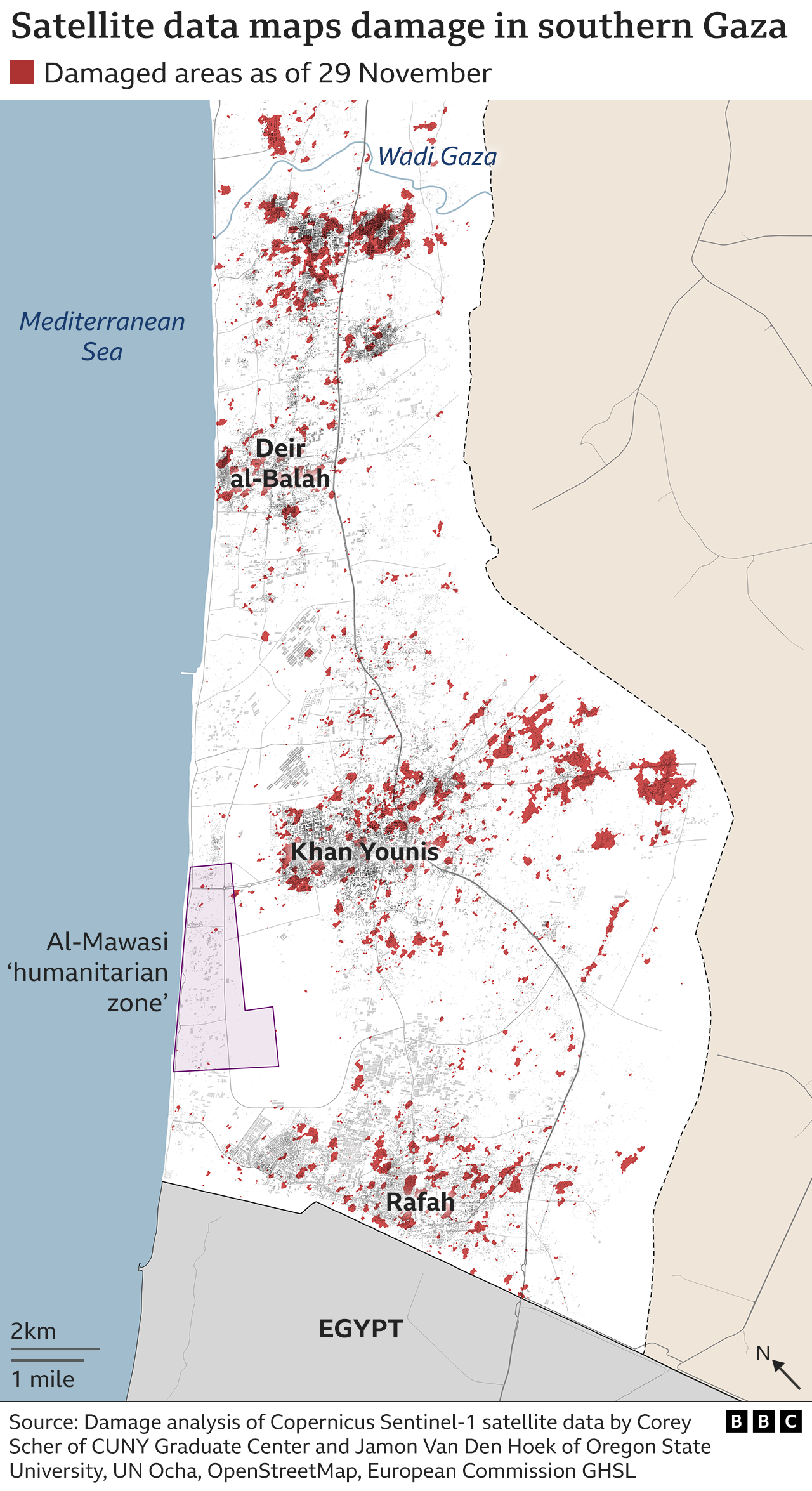
Satellite data analysis suggest say almost 98,000 buildings across di whole Gaza Strip don suffer damage, as di damages plenti for di northern part of di kontri – as we don see for di map above.
Na Corey Scher of City University of New York Graduate Center and Jamon Van Den Hoek of Oregon State University do di analysis of data. E dey based on comparisons of two separate images, and e dey reveal changes for di height or structure of buildings wey suggest damage.
We don analyse di satellite fotos from several areas wey get big damage.
North-eastern area wey first air strikes hit
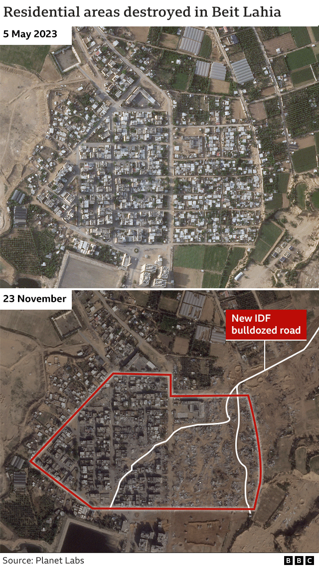
Di cities of Beit Lahia and Beit Hanoun for di north and north-east of di Gaza Strip dey among di first place wey dem target wit air strikes afta di 7 October attack by Hamas. Di Israel Defense Forces (IDF) tok say di area na hideout for Hamas.
Parts of Beit Lahia, wey olive groves and sand dunes dey for Israel border, don flat. Di satellite foto below show area for di north-east of Beit Lahia, wia dem destroy buildings.
Bulldozers dey clear di roads through di dust and di Israeli military clear land and set up defensive position for di field.
Di IDF also attack di nearby city of Beit Hanoun, less dan 1.6km (1 mile) from di border. Na 120 targets dem hit for di area on di first day of air strikes.
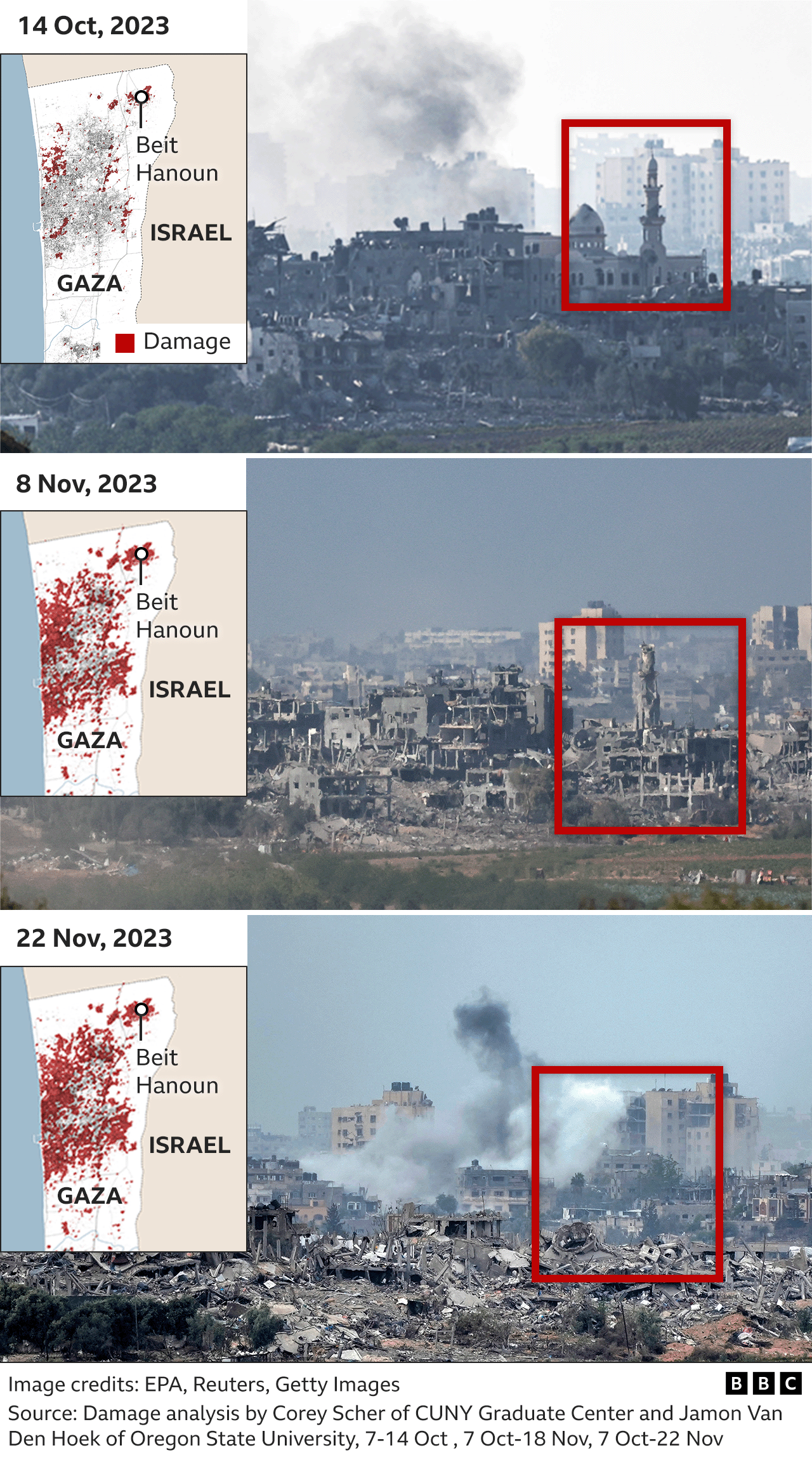
As di foto above show, one skyline of multi-storey building and one mosque don gradually turn to dust between 14 October and 22 November.
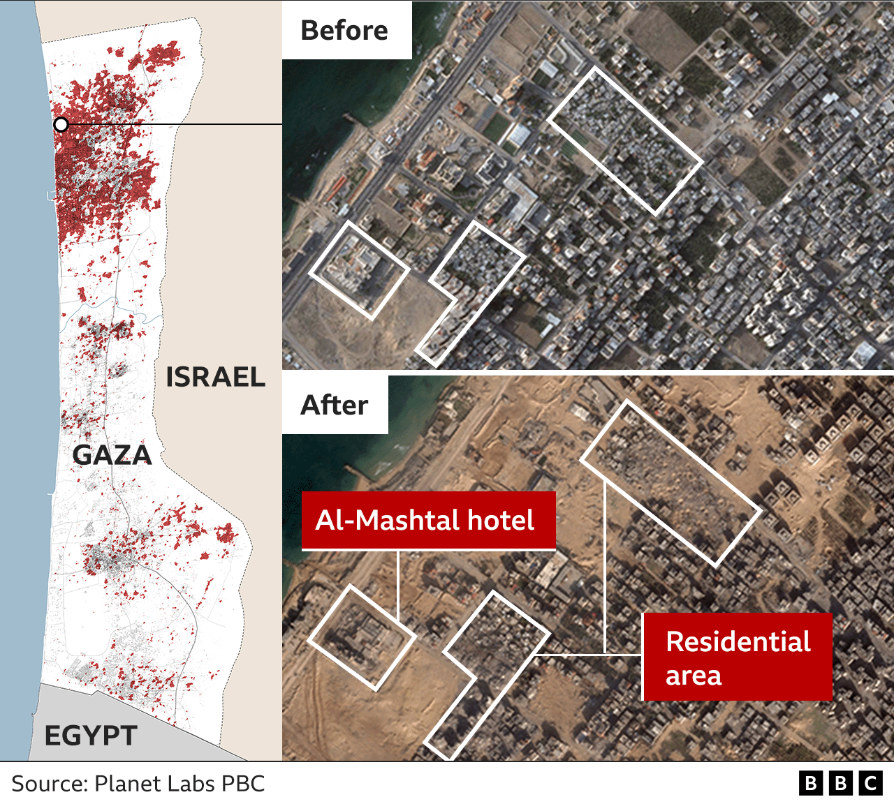
Dem damage five-star hotel, dem flatten nearby neighbourhood
Afta weeks of air strikes on Gaza, Israel move in tanks and bulldozers to di area wey dem don heavily attack. Di IDF work from southwards to di coast towards Shati (Beach) refugee camp, for Gaza City area.
As di foto below show, na whole series of craters dey visible for place wey be residential area before. Some of di buildings for di beach front, wey get Gaza first five-star hotel, di Al-Mashtal, as well as huts and restaurants, dem don partially destroy am.
For one week afta di air strikes start, di IDF warn Palestinians wey dey northern Gaza to move go south of one river wey dem sabi as Wadi Gaza for dia safety.
Despite di warning and hundreds of thousands of pipo wey run comot Gaza City, areas for di south still dey dia target.
Damage and Israeli order send millions of pipo go southern Gaza city
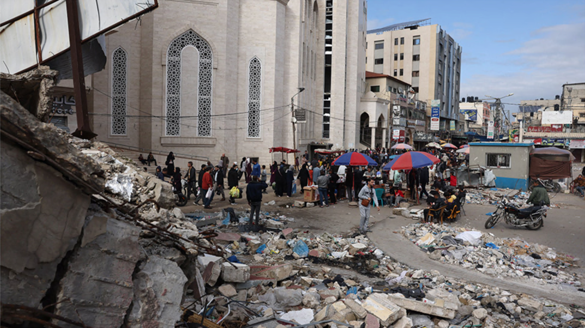
For Khan Younis, southern Gaza, thousands of pipo dey live for tents or di building wey bomb don tear down.
Although di damage no be for everi wia for north, up to 15% of buildings across di city fit don damage, according to Corey Scher and Jamon Van Den Hoek analysis.
Di break for di air strikes wey di truce bin create don encourage some pipo to venture out to markets. For di foto below, you fit see damaged buildings near di city Grand Mosque.
Israel put diasef for long fight
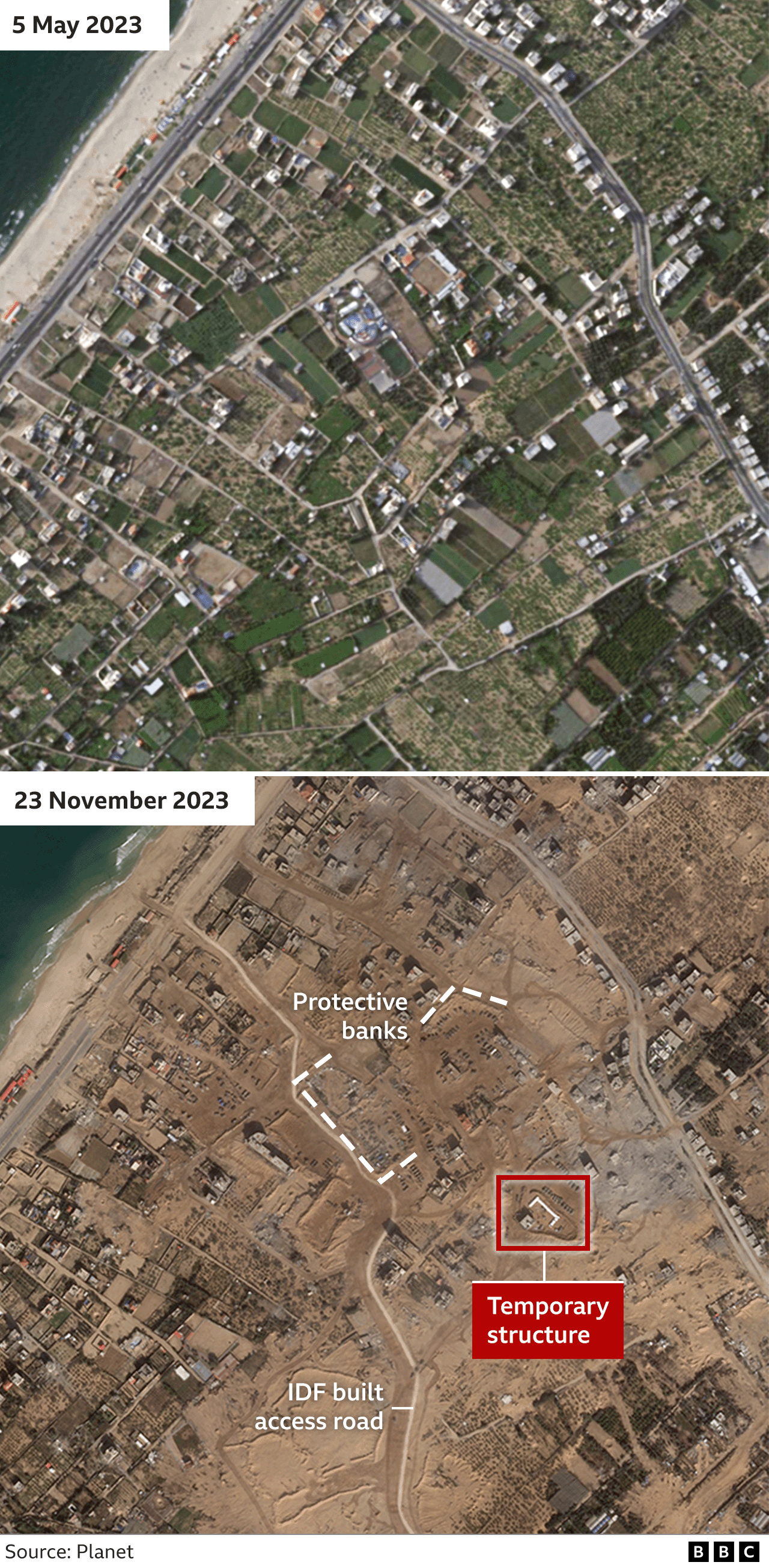
Israeli militants also dey for Gaza Strip westwards, as dem dey isolate Gaza City from di south.
Inside di foto from di south of Gaza City, we go see di place pipo bin dey live before, IDF don clear am wit heavy machinery and road wey dem clear towards di western Mediterranean shoreline.
You fit see di dozens of military vehicles, including tanks, grouped behind fortifications made from earth.
Satellite foto also show open square of land wit Star of David wey dem carve for ground by vehicle track for Gaza City, near al-Azhar University.
Fotos online from before di war show children as dem dey play dia and e suggest say na park, but IDF tok-tok pesin Rear Adm Daniel Hagari tok say Hamas bin dey use di ground as parade square near one base. Na IDF Golani Brigade take ova di area.
Star of David – na Jewish and Israeli symbol – dem make wit armoured vehicles for ceremony wey dey im memory of Israeli sojas wey dem bin kill since di war start, Rear Adm Hagari bin post for im X page.

Additional reporting na from Thomas Spencer, Jake Horton, Alex Murray, Shayan Sardarizadeh and Jemimah Herd